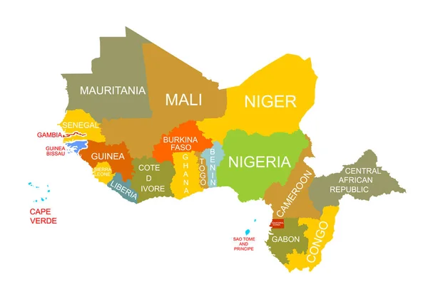
Western Africa vector map high detailed silhouette illustration isolated on white background. Western Africa regional map with separated borders without country members. Cote d Ivore map.
Esta foto
Western Africa vector map high detailed silhouette illustration isolated on white background. Western Africa regional map with separated borders without country members. Cote d Ivore map..
Datos de la Imágen (tiene derechos de autor*)
- Fotografía:
-
Western Africa vector map high detailed silhouette illustration isolated on white background. Western Africa regional map with separated borders without country members. Cote d Ivore map.
- Autor:
- Ancho original:
-
6067 píxeles.
- Altura original:
-
4181 píxeles.
- Tamaño:
-
25.37 megapíxeles.
- Categorías:
-
- Palabras Clave:
-
Níger Argelia estado isla Atlas Administrativo Benín mapa guayana provincia Malí Tierras Gráfico Congo Santo Tomé y Príncipe Mauritania geografía bissau de Guinea Gabón forma Libia Camerún Liberia ilustración Sierra Leona República Centroafricana región Burkina faso vector Togo Territorio frontera Guinea Gambia colonialismo zona cartografía viajes esclavo país División Continente Nigeria Costa de Marfil Cabo Verde Senegal política economía África .
Popularidad
- Vistas:
- 5
- Descargas:
- 1

Fotos similares
Otros temas con fotografías que le puede interesar
- vector
- Benín
- Libia
- Sierra Leona
- Gambia
- Continente
- División
- ilustración
- región
- Gráfico
- provincia
- Costa de Marfil
- cartografía
- geografía
- economía
- forma
- isla
- guayana
- Argelia
- bissau de Guinea
- Liberia
- Estado
- esclavo
- Tierras
- Santo Tomé y Príncipe
- mapa
- Territorio
- Togo
- Viajes
- África
- zona
- Burkina faso
- país
- frontera
- República Centroafricana
- Senegal
- Cabo Verde
- Congo
- colonialismo
- Política
- Mauritania
- Nigeria
- Guinea
- Malí
- Camerún
- Níger
- Atlas
- Gabón
- Administrativo
(*) Sitio para adquirir: Link externo para Comprar
Fotografía de Western Africa vector map high detailed silhouette illustration isolated on white background. Western Africa regional map with separated borders without country members. Cote d Ivore map., que incluye Western Africa vector map high detailed silhouette illustration isolated on white background. Western Africa regional map with separated borders without country members. Cote d Ivore map..
Todas las imágenes por Depositphotos