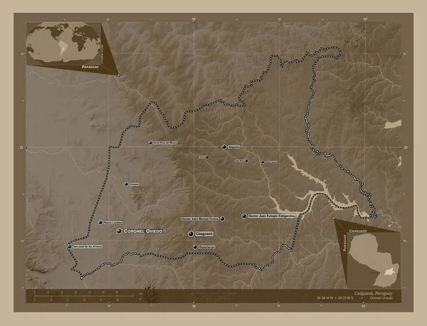
Caaguazu, department of Paraguay. Elevation map colored in sepia tones with lakes and rivers. Locations and names of major cities of the region. Corner auxiliary location maps
Esta foto
Caaguazu, department of Paraguay. Elevation map colored in sepia tones with lakes and rivers. Locations and names of major cities of the region. Corner auxiliary location maps.
Datos de la Imágen (tiene derechos de autor*)
- Fotografía:
-
Caaguazu, department of Paraguay. Elevation map colored in sepia tones with lakes and rivers. Locations and names of major cities of the region. Corner auxiliary location maps
- Autor:
- Ancho original:
-
4930 píxeles.
- Altura original:
-
3770 píxeles.
- Tamaño:
-
18.59 megapíxeles.
- Categorías:
-
- Palabras Clave:
-
región Paraguay caaguazú asuncian forma ¡Pry! estereográfico Capital social Atlas Zoom: Continente doctor juan eulogio estigarribia geografía división administrativa contorno América del Sur repatriacion doctor juan manuel frutos yaka reta Territorio planeta vaqueria Naturaleza país santa rosa del mbutuy Yhu santa Teresa Leyenda mundo tierra mapa océano san jose de los arroyos esquema Ciencia nueva londres coronel oviedo carayao Tierras frontera Departamento .
Popularidad
- Vistas:
- 0
- Descargas:
- 0

Fotos similares
Otros temas con fotografías que le puede interesar
- doctor juan manuel frutos
- nueva londres
- caaguazú
- asuncian
- mundo
- Capital social
- Santa Teresa
- contorno
- esquema
- Leyenda
- forma
- doctor juan eulogio estigarribia
- Departamento
- país
- Territorio
- Yhu
- Paraguay
- Continente
- región
- repatriacion
- frontera
- geografía
- tierra
- yaka reta
- vaqueria
- Ciencia
- estereográfico
- división administrativa
- planeta
- Zoom:
- América del Sur
- océano
- santa rosa del mbutuy
- carayao
- mapa
- ¡Pry!
- Naturaleza
- Tierras
- Atlas
- san jose de los arroyos
- coronel oviedo
(*) Sitio para adquirir: Link externo para Comprar
Fotografía de Caaguazu, department of Paraguay. Elevation map colored in sepia tones with lakes and rivers. Locations and names of major cities of the region. Corner auxiliary location maps, que incluye Caaguazu, department of Paraguay. Elevation map colored in sepia tones with lakes and rivers. Locations and names of major cities of the region. Corner auxiliary location maps.
Todas las imágenes por Depositphotos