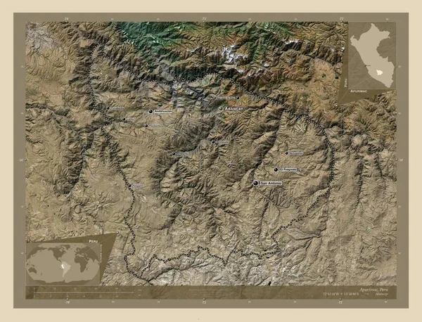
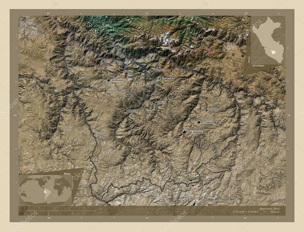
Apurimac, region of Peru. High resolution satellite map. Locations and names of major cities of the region. Corner auxiliary location maps
Esta foto
Apurimac, region of Peru. High resolution satellite map. Locations and names of major cities of the region. Corner auxiliary location maps.
Datos de la Imágen (tiene derechos de autor*)
- Fotografía:
-
Apurimac, region of Peru. High resolution satellite map. Locations and names of major cities of the region. Corner auxiliary location maps
- Autor:
- Ancho original:
-
4930 píxeles.
- Altura original:
-
3770 píxeles.
- Tamaño:
-
18.59 megapíxeles.
- Categorías:
-
- Palabras Clave:
-
el progreso molinopampa océano Tierras acobamba San Antonio contorno Continente América del Sur estereográfico Atlas San Jerónimo geografía Leyenda tierra Capital social Talavera división administrativa Naturaleza pampachiri esquema Zoom: país Por Abancay Ciencia apurimaco andahuaylas nueva esperanza pomabamba Lima Territorio región planeta san juan de dios mapa rinconada perú Lamay mundo forma piscobamba frontera vilcabamba .
Popularidad
- Vistas:
- 0
- Descargas:
- 0
Fotos similares
Otros temas con fotografías que le puede interesar
- Territorio
- planeta
- Naturaleza
- pomabamba
- San Antonio
- san juan de dios
- San Jerónimo
- acobamba
- forma
- rinconada
- Abancay
- Talavera
- país
- Continente
- océano
- frontera
- molinopampa
- mundo
- piscobamba
- andahuaylas
- Lima
- Por
- Atlas
- el progreso
- perú
- geografía
- vilcabamba
- mapa
- estereográfico
- contorno
- Lamay
- región
- división administrativa
- Capital social
- pampachiri
- nueva esperanza
- Zoom:
- tierra
- Leyenda
- Tierras
- apurimaco
- esquema
- Ciencia
- América del Sur
(*) Sitio para adquirir: Link externo para Comprar
Fotografía de Apurimac, region of Peru. High resolution satellite map. Locations and names of major cities of the region. Corner auxiliary location maps, que incluye Apurimac, region of Peru. High resolution satellite map. Locations and names of major cities of the region. Corner auxiliary location maps.
Todas las imágenes por Depositphotos