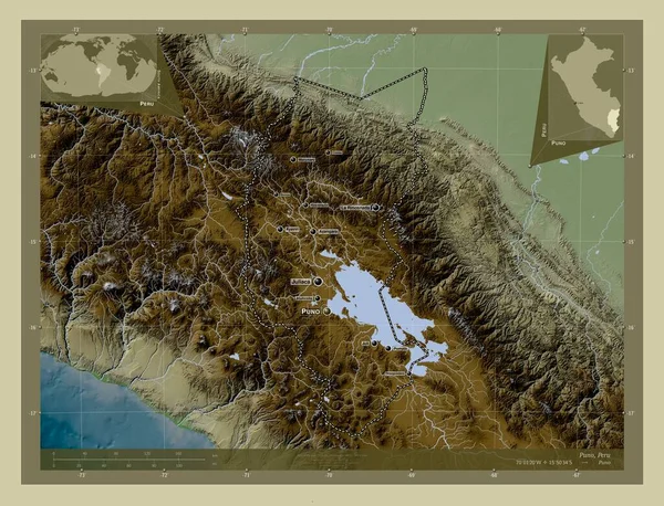
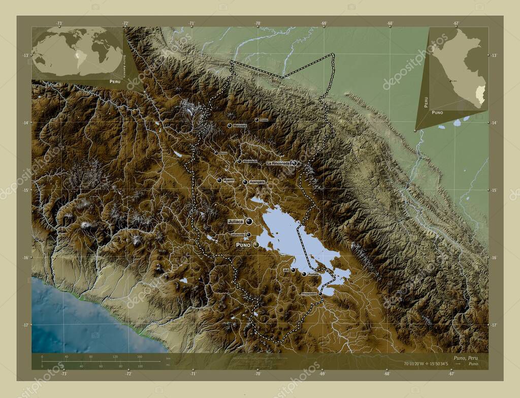
Puno, region of Peru. Elevation map colored in wiki style with lakes and rivers. Locations and names of major cities of the region. Corner auxiliary location maps
Esta foto
Puno, region of Peru. Elevation map colored in wiki style with lakes and rivers. Locations and names of major cities of the region. Corner auxiliary location maps.
Datos de la Imágen (tiene derechos de autor*)
- Fotografía:
-
Puno, region of Peru. Elevation map colored in wiki style with lakes and rivers. Locations and names of major cities of the region. Corner auxiliary location maps
- Autor:
- Ancho original:
-
4930 píxeles.
- Altura original:
-
3770 píxeles.
- Tamaño:
-
18.59 megapíxeles.
- Categorías:
-
- Palabras Clave:
-
mundo geografía Atlas Puno perú mapa rinconada país Ciencia frontera esquema Capital social Naturaleza atuncolla océano división administrativa Desaguadero Juliaca pomata Continente Juli tierra Lima estereográfico Ñuñoa región Por Zoom: La Rinconada planeta santa Lucía Leyenda Tierras macusani forma contorno Territorio América del Sur coasa azangaro .
Popularidad
- Vistas:
- 0
- Descargas:
- 0
Fotos similares
Otros temas con fotografías que le puede interesar
- Puno
- Juliaca
- Ciencia
- atuncolla
- Atlas
- Naturaleza
- esquema
- geografía
- Leyenda
- Territorio
- mundo
- mapa
- pomata
- Capital social
- coasa
- Santa Lucía
- planeta
- Tierras
- rinconada
- macusani
- azangaro
- Juli
- Zoom:
- América del Sur
- Ñuñoa
- Por
- Desaguadero
- La Rinconada
- región
- división administrativa
- estereográfico
- frontera
- tierra
- contorno
- perú
- forma
- Continente
- océano
- Lima
- país
(*) Sitio para adquirir: Link externo para Comprar
Fotografía de Puno, region of Peru. Elevation map colored in wiki style with lakes and rivers. Locations and names of major cities of the region. Corner auxiliary location maps, que incluye Puno, region of Peru. Elevation map colored in wiki style with lakes and rivers. Locations and names of major cities of the region. Corner auxiliary location maps.
Todas las imágenes por Depositphotos