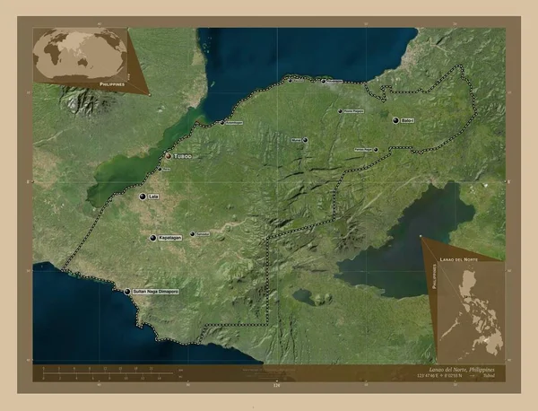
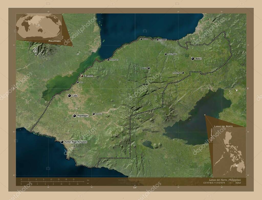
Lanao del Norte, province of Philippines. Low resolution satellite map. Locations and names of major cities of the region. Corner auxiliary location maps
Esta foto
Lanao del Norte, province of Philippines. Low resolution satellite map. Locations and names of major cities of the region. Corner auxiliary location maps.
Datos de la Imágen (tiene derechos de autor*)
- Fotografía:
-
Lanao del Norte, province of Philippines. Low resolution satellite map. Locations and names of major cities of the region. Corner auxiliary location maps
- Autor:
- Ancho original:
-
4930 píxeles.
- Altura original:
-
3770 píxeles.
- Tamaño:
-
18.59 megapíxeles.
- Categorías:
-
- Palabras Clave:
-
país Naturaleza provincia Continente Lala tierra Asia planeta Capital social Filipinas frontera munai mapa Salvador Bacolod Zoom: pantao ragat Ciencia tubod kolambugan división administrativa Territorio kapatagan contorno Tierras región kauswagan forma lanao del norte océano estereográfico balo i geografía Leyenda Atlas phl sultan naga dimaporo poona piagapo baroy esquema Manila mundo .
Popularidad
- Vistas:
- 1
- Descargas:
- 0
Fotos similares
Otros temas con fotografías que le puede interesar
- tierra
- Salvador
- kapatagan
- Bacolod
- pantao ragat
- contorno
- munai
- tubod
- Lala
- kolambugan
- planeta
- mapa
- océano
- Territorio
- Capital social
- kauswagan
- Ciencia
- poona piagapo
- Continente
- Leyenda
- Naturaleza
- forma
- Tierras
- esquema
- mundo
- Zoom:
- baroy
- región
- estereográfico
- geografía
- Filipinas
- Asia
- lanao del norte
- provincia
- país
- Manila
- balo i
- división administrativa
- frontera
- sultan naga dimaporo
- phl
- Atlas
(*) Sitio para adquirir: Link externo para Comprar
Fotografía de Lanao del Norte, province of Philippines. Low resolution satellite map. Locations and names of major cities of the region. Corner auxiliary location maps, que incluye Lanao del Norte, province of Philippines. Low resolution satellite map. Locations and names of major cities of the region. Corner auxiliary location maps.
Todas las imágenes por Depositphotos