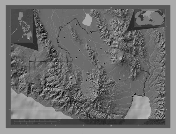
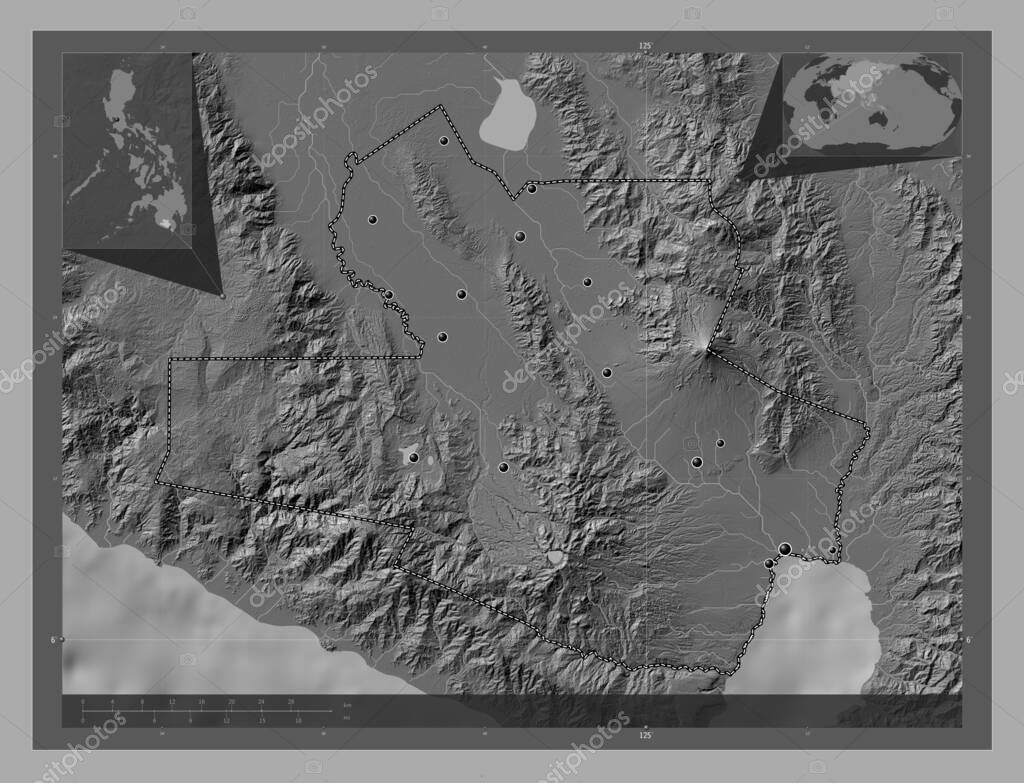
South Cotabato, province of Philippines. Bilevel elevation map with lakes and rivers. Locations of major cities of the region. Corner auxiliary location maps
Esta foto
South Cotabato, province of Philippines. Bilevel elevation map with lakes and rivers. Locations of major cities of the region. Corner auxiliary location maps.
Datos de la Imágen (tiene derechos de autor*)
- Fotografía:
-
South Cotabato, province of Philippines. Bilevel elevation map with lakes and rivers. Locations of major cities of the region. Corner auxiliary location maps
- Autor:
- Ancho original:
-
4930 píxeles.
- Altura original:
-
3770 píxeles.
- Tamaño:
-
18.59 megapíxeles.
- Categorías:
-
- Palabras Clave:
-
santo nino tantangan lago sebu Territorio geografía polomolok tierra mapa división administrativa esquema forma buayan surallah Asia estereográfico región Continente provincia océano norala Zoom: país Naturaleza Banga Atlas tampakan coronadal Manila frontera contorno Tierras sitio de la fábrica de conservas phl Leyenda tupí lutayan mundo Filipinas South Cotabato Ciencia Capital social labangal planeta General santos .
Popularidad
- Vistas:
- 0
- Descargas:
- 0
Fotos similares
Otros temas con fotografías que le puede interesar
- lago sebu
- Filipinas
- Tierras
- forma
- lutayan
- tampakan
- Ciencia
- Leyenda
- polomolok
- South Cotabato
- región
- Asia
- surallah
- Atlas
- Manila
- Naturaleza
- planeta
- división administrativa
- tupí
- sitio de la fábrica de conservas
- labangal
- tantangan
- Territorio
- Banga
- mundo
- coronadal
- océano
- provincia
- buayan
- Continente
- General santos
- tierra
- mapa
- país
- estereográfico
- contorno
- frontera
- norala
- Capital social
- Zoom:
- geografía
- esquema
- santo nino
- phl
(*) Sitio para adquirir: Link externo para Comprar
Fotografía de South Cotabato, province of Philippines. Bilevel elevation map with lakes and rivers. Locations of major cities of the region. Corner auxiliary location maps, que incluye South Cotabato, province of Philippines. Bilevel elevation map with lakes and rivers. Locations of major cities of the region. Corner auxiliary location maps.
Todas las imágenes por Depositphotos