
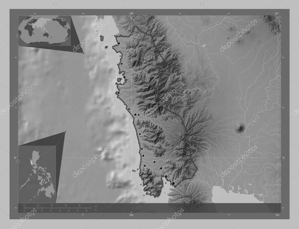
Zambales, province of Philippines. Grayscale elevation map with lakes and rivers. Locations of major cities of the region. Corner auxiliary location maps
Esta foto
Zambales, province of Philippines. Grayscale elevation map with lakes and rivers. Locations of major cities of the region. Corner auxiliary location maps.
Datos de la Imágen (tiene derechos de autor*)
- Fotografía:
-
Zambales, province of Philippines. Grayscale elevation map with lakes and rivers. Locations of major cities of the region. Corner auxiliary location maps
- Autor:
- Ancho original:
-
4930 píxeles.
- Altura original:
-
3770 píxeles.
- Tamaño:
-
18.59 megapíxeles.
- Categorías:
-
- Palabras Clave:
-
frontera phl Capital social Iba provincia old cabalan masinloc tierra océano Zambales palauig Olongapo cabangan Candelaria San Marcelino Ciencia contorno mapa botolan Naturaleza paudpod Territorio Filipinas país planeta geografía Continente Zoom: división administrativa estereográfico san narciso mundo Asia esquema subic castillejos Manila Tierras San Felipe Atlas región santa Cruz Leyenda forma San Antonio .
Popularidad
- Vistas:
- 2
- Descargas:
- 0
Fotos similares
Otros temas con fotografías que le puede interesar
- cabangan
- Manila
- planeta
- san narciso
- Filipinas
- Continente
- Zambales
- esquema
- tierra
- región
- old cabalan
- forma
- castillejos
- Naturaleza
- provincia
- Leyenda
- Atlas
- Ciencia
- palauig
- phl
- geografía
- Capital social
- Tierras
- subic
- Iba
- Candelaria
- masinloc
- paudpod
- Olongapo
- país
- océano
- contorno
- Asia
- Santa Cruz
- Zoom:
- mundo
- botolan
- frontera
- mapa
- Territorio
- división administrativa
- San Marcelino
- estereográfico
- San Felipe
- San Antonio
(*) Sitio para adquirir: Link externo para Comprar
Fotografía de Zambales, province of Philippines. Grayscale elevation map with lakes and rivers. Locations of major cities of the region. Corner auxiliary location maps, que incluye Zambales, province of Philippines. Grayscale elevation map with lakes and rivers. Locations of major cities of the region. Corner auxiliary location maps.
Todas las imágenes por Depositphotos