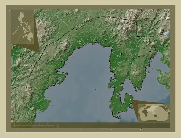
Zamboanga Sibugay, province of Philippines. Elevation map colored in wiki style with lakes and rivers. Locations of major cities of the region. Corner auxiliary location maps
Esta foto
Zamboanga Sibugay, province of Philippines. Elevation map colored in wiki style with lakes and rivers. Locations of major cities of the region. Corner auxiliary location maps.
Datos de la Imágen (tiene derechos de autor*)
- Fotografía:
-
Zamboanga Sibugay, province of Philippines. Elevation map colored in wiki style with lakes and rivers. Locations of major cities of the region. Corner auxiliary location maps
- Autor:
- Ancho original:
-
4930 píxeles.
- Altura original:
-
3770 píxeles.
- Tamaño:
-
18.59 megapíxeles.
- Categorías:
-
- Palabras Clave:
-
Capital social olutanga Continente buug mapa Leyenda Asia diplahan talusan Atlas zamboanga sibugay país planeta Naturaleza Alicia phl forma roseller lim Zoom: geografía Manila malangas tungawan frontera mundo siay Imelda kabasalan océano Territorio contorno Naga región mabuhay tierra payao división administrativa Ipil estereográfico provincia esquema Ciencia Filipinas Tierras titay .
Popularidad
- Vistas:
- 0
- Descargas:
- 0

Fotos similares
Otros temas con fotografías que le puede interesar
- titay
- región
- Asia
- malangas
- división administrativa
- mundo
- Leyenda
- Tierras
- Territorio
- Manila
- país
- Capital social
- mapa
- esquema
- Zoom:
- kabasalan
- olutanga
- frontera
- Ciencia
- contorno
- estereográfico
- Naga
- océano
- buug
- Imelda
- planeta
- payao
- tierra
- Filipinas
- forma
- geografía
- diplahan
- Ipil
- siay
- provincia
- zamboanga sibugay
- roseller lim
- tungawan
- Continente
- talusan
- Naturaleza
- Atlas
- phl
- mabuhay
- Alicia
(*) Sitio para adquirir: Link externo para Comprar
Fotografía de Zamboanga Sibugay, province of Philippines. Elevation map colored in wiki style with lakes and rivers. Locations of major cities of the region. Corner auxiliary location maps, que incluye Zamboanga Sibugay, province of Philippines. Elevation map colored in wiki style with lakes and rivers. Locations of major cities of the region. Corner auxiliary location maps.
Todas las imágenes por Depositphotos