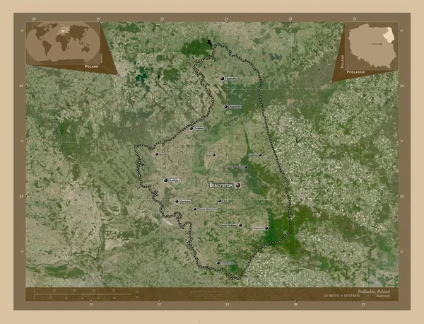
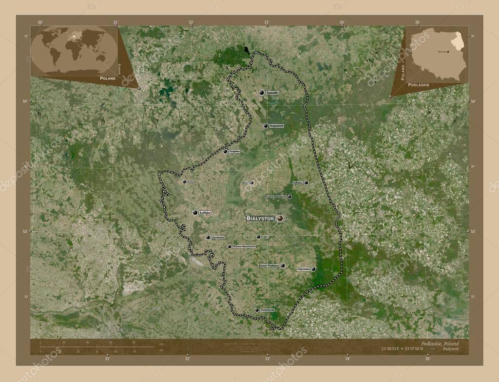
Podlaskie, voivodeship|province of Poland. Low resolution satellite map. Locations and names of major cities of the region. Corner auxiliary location maps
Esta foto
Podlaskie, voivodeship|province of Poland. Low resolution satellite map. Locations and names of major cities of the region. Corner auxiliary location maps.
Datos de la Imágen (tiene derechos de autor*)
- Fotografía:
-
Podlaskie, voivodeship|province of Poland. Low resolution satellite map. Locations and names of major cities of the region. Corner auxiliary location maps
- Autor:
- Ancho original:
-
4930 píxeles.
- Altura original:
-
3770 píxeles.
- Tamaño:
-
18.59 megapíxeles.
- Categorías:
-
- Palabras Clave:
-
planeta grajewo siemiatycze Podlaskie Tierras mundo POL Polonia Leyenda provincia voivodato Europa hajnowka Ciencia división administrativa wysokie mazowieckie czarna bialostocka forma lomza geografía contorno océano sokolka Territorio bielsk podlaski mapa Naturaleza frontera Atlas kolno Augustow zambrow Monki país suwalki Bialystok región wasilkow Capital social estereográfico Continente Zoom: esquema tierra .
Popularidad
- Vistas:
- 0
- Descargas:
- 0
Fotos similares
Otros temas con fotografías que le puede interesar
- océano
- Tierras
- Atlas
- geografía
- Continente
- Naturaleza
- Monki
- voivodato
- provincia
- planeta
- Europa
- estereográfico
- tierra
- frontera
- Bialystok
- hajnowka
- siemiatycze
- esquema
- czarna bialostocka
- Territorio
- mundo
- forma
- división administrativa
- suwalki
- sokolka
- Polonia
- Capital social
- bielsk podlaski
- contorno
- wasilkow
- Augustow
- lomza
- wysokie mazowieckie
- mapa
- Podlaskie
- región
- grajewo
- kolno
- Ciencia
- Zoom:
- país
- zambrow
- Leyenda
- POL
(*) Sitio para adquirir: Link externo para Comprar
Fotografía de Podlaskie, voivodeship|province of Poland. Low resolution satellite map. Locations and names of major cities of the region. Corner auxiliary location maps, que incluye Podlaskie, voivodeship|province of Poland. Low resolution satellite map. Locations and names of major cities of the region. Corner auxiliary location maps.
Todas las imágenes por Depositphotos