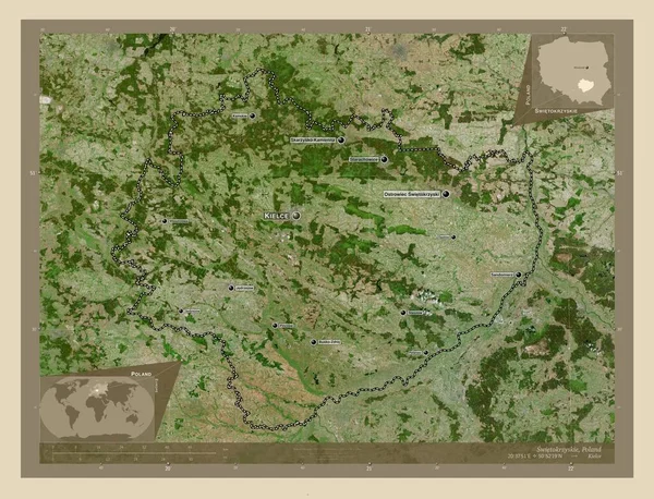
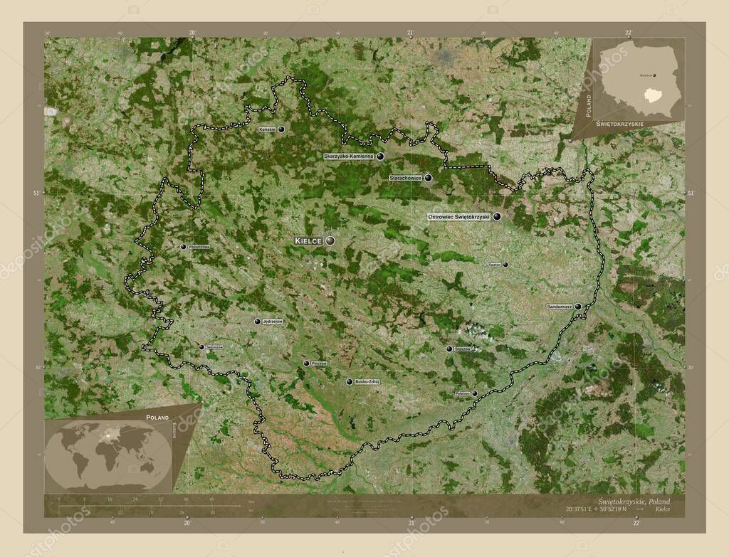
Swietokrzyskie, voivodeship|province of Poland. High resolution satellite map. Locations and names of major cities of the region. Corner auxiliary location maps
Esta foto
Swietokrzyskie, voivodeship|province of Poland. High resolution satellite map. Locations and names of major cities of the region. Corner auxiliary location maps.
Datos de la Imágen (tiene derechos de autor*)
- Fotografía:
-
Swietokrzyskie, voivodeship|province of Poland. High resolution satellite map. Locations and names of major cities of the region. Corner auxiliary location maps
- Autor:
- Ancho original:
-
4930 píxeles.
- Altura original:
-
3770 píxeles.
- Tamaño:
-
18.59 megapíxeles.
- Categorías:
-
- Palabras Clave:
-
starachowice geografía Europa frontera Tal vez Ostrowiec swietokrzyski busko zdroj región Swietokrzyskie Jedrzejow ¡Patów! Kielce estereográfico tierra Polonia planeta contorno Naturaleza Sandomierz Leyenda staszow Atlas mapa wloszczowa Tierras voivodato país Territorio provincia división administrativa Konskie Ciencia mundo sedziszow esquema Pinczow forma Zoom: Skarzysko Kamienna Capital social polaniec Continente océano POL staporkow .
Popularidad
- Vistas:
- 0
- Descargas:
- 0
Fotos similares
Otros temas con fotografías que le puede interesar
- Tal vez
- Sandomierz
- staporkow
- estereográfico
- sedziszow
- staszow
- Naturaleza
- Zoom:
- busko zdroj
- Kielce
- Ciencia
- Pinczow
- Capital social
- frontera
- Konskie
- geografía
- Leyenda
- voivodato
- Jedrzejow
- Tierras
- esquema
- ¡Patów!
- contorno
- Swietokrzyskie
- océano
- división administrativa
- mapa
- provincia
- Polonia
- Skarzysko Kamienna
- forma
- polaniec
- Europa
- país
- starachowice
- planeta
- wloszczowa
- Territorio
- Ostrowiec swietokrzyski
- región
- tierra
- Continente
- Atlas
- POL
- mundo
(*) Sitio para adquirir: Link externo para Comprar
Fotografía de Swietokrzyskie, voivodeship|province of Poland. High resolution satellite map. Locations and names of major cities of the region. Corner auxiliary location maps, que incluye Swietokrzyskie, voivodeship|province of Poland. High resolution satellite map. Locations and names of major cities of the region. Corner auxiliary location maps.
Todas las imágenes por Depositphotos