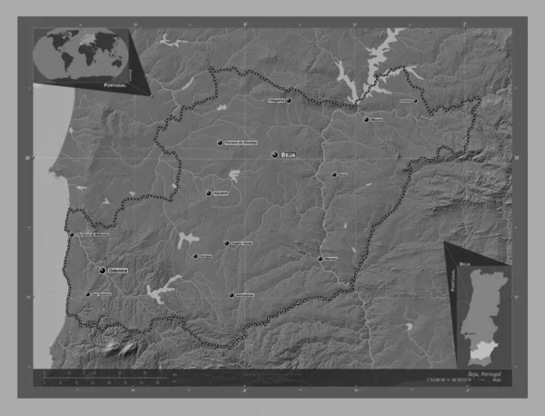
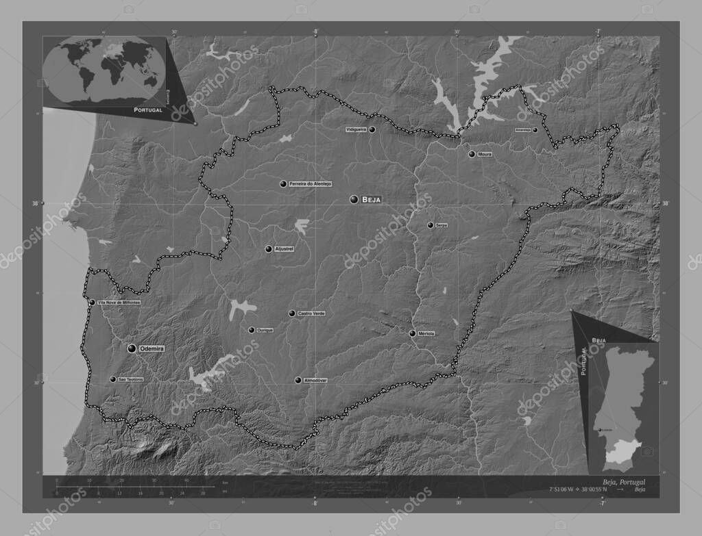
Beja, district of Portugal. Bilevel elevation map with lakes and rivers. Locations and names of major cities of the region. Corner auxiliary location maps
Esta foto
Beja, district of Portugal. Bilevel elevation map with lakes and rivers. Locations and names of major cities of the region. Corner auxiliary location maps.
Datos de la Imágen (tiene derechos de autor*)
- Fotografía:
-
Beja, district of Portugal. Bilevel elevation map with lakes and rivers. Locations and names of major cities of the region. Corner auxiliary location maps
- Autor:
- Ancho original:
-
4930 píxeles.
- Altura original:
-
3770 píxeles.
- Tamaño:
-
18.59 megapíxeles.
- Categorías:
-
- Palabras Clave:
-
Atlas estereográfico Naturaleza Moura geografía tierra Continente Mertola Cuba Serpa distrito prt país sao teotonio Castro verde Europa Vila Nova de Milfontes Lisboa Odemira Ourique esquema Portugal Ciencia división administrativa mapa Alvito Leyenda región frontera océano Beja vidigueira Zoom: Tierras Capital social Almodovar Aljustrel forma planeta Ferreira alentejo contorno Territorio mundo amareleja .
Popularidad
- Vistas:
- 0
- Descargas:
- 0
Fotos similares
Otros temas con fotografías que le puede interesar
- Portugal
- prt
- Naturaleza
- Atlas
- forma
- Lisboa
- Continente
- Leyenda
- vidigueira
- Mertola
- Europa
- distrito
- Ourique
- Tierras
- océano
- mundo
- Castro verde
- frontera
- país
- Ciencia
- Territorio
- Alvito
- división administrativa
- Vila Nova de Milfontes
- mapa
- tierra
- planeta
- Aljustrel
- estereográfico
- Odemira
- sao teotonio
- Ferreira alentejo
- Serpa
- región
- contorno
- Beja
- Moura
- Capital social
- geografía
- Almodovar
- Cuba
- amareleja
- Zoom:
- esquema
(*) Sitio para adquirir: Link externo para Comprar
Fotografía de Beja, district of Portugal. Bilevel elevation map with lakes and rivers. Locations and names of major cities of the region. Corner auxiliary location maps, que incluye Beja, district of Portugal. Bilevel elevation map with lakes and rivers. Locations and names of major cities of the region. Corner auxiliary location maps.
Todas las imágenes por Depositphotos