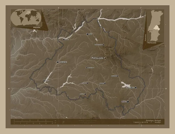
Portalegre, district of Portugal. Elevation map colored in sepia tones with lakes and rivers. Locations and names of major cities of the region. Corner auxiliary location maps
Esta foto
Portalegre, district of Portugal. Elevation map colored in sepia tones with lakes and rivers. Locations and names of major cities of the region. Corner auxiliary location maps.
Datos de la Imágen (tiene derechos de autor*)
- Fotografía:
-
Portalegre, district of Portugal. Elevation map colored in sepia tones with lakes and rivers. Locations and names of major cities of the region. Corner auxiliary location maps
- Autor:
- Ancho original:
-
4930 píxeles.
- Altura original:
-
3770 píxeles.
- Tamaño:
-
18.59 megapíxeles.
- Categorías:
-
- Palabras Clave:
-
Fronteira Monforte forma Europa Lisboa arronchas sousel Tierras campo maior mundo contorno Zoom: división administrativa Portugal Capital social prt Ciencia Nisa planeta frontera Portalegre océano tierra Naturaleza Alter chao Leyenda Castillo de vide ponte de sor gavião Continente región distrito país Montargil estereográfico Elvas mapa guerra atalaia Territorio geografía Crato esquema Atlas .
Popularidad
- Vistas:
- 0
- Descargas:
- 0

Fotos similares
Otros temas con fotografías que le puede interesar
- división administrativa
- prt
- país
- contorno
- forma
- Portugal
- Europa
- Ciencia
- estereográfico
- Nisa
- arronchas
- Tierras
- gavião
- sousel
- ponte de sor
- distrito
- Fronteira
- Continente
- Alter chao
- Capital social
- esquema
- Territorio
- guerra atalaia
- mapa
- geografía
- campo maior
- Naturaleza
- Crato
- Leyenda
- planeta
- Montargil
- tierra
- océano
- Elvas
- Atlas
- Zoom:
- Lisboa
- Portalegre
- región
- frontera
- Monforte
- mundo
- Castillo de vide
(*) Sitio para adquirir: Link externo para Comprar
Fotografía de Portalegre, district of Portugal. Elevation map colored in sepia tones with lakes and rivers. Locations and names of major cities of the region. Corner auxiliary location maps, que incluye Portalegre, district of Portugal. Elevation map colored in sepia tones with lakes and rivers. Locations and names of major cities of the region. Corner auxiliary location maps.
Todas las imágenes por Depositphotos