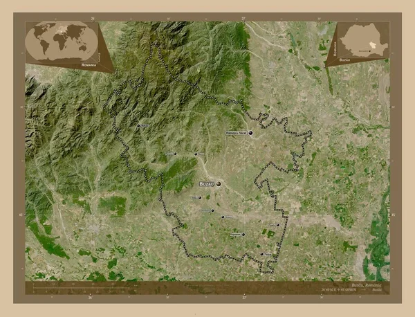
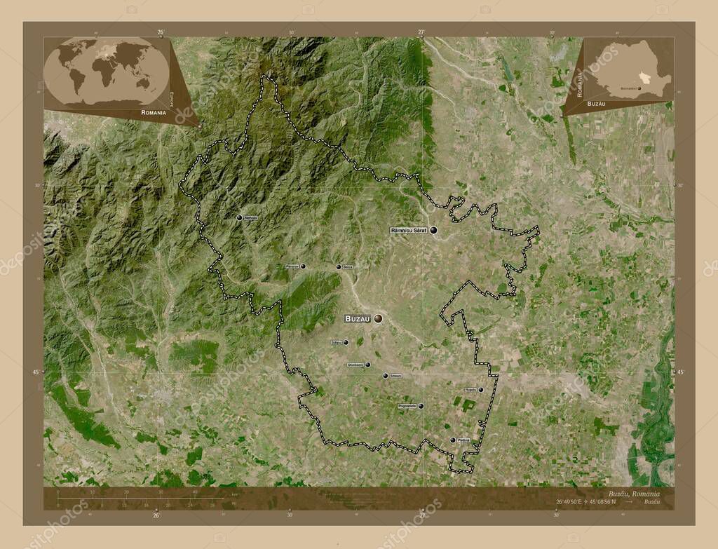
Buzau, county of Romania. Low resolution satellite map. Locations and names of major cities of the region. Corner auxiliary location maps
Esta foto
Buzau, county of Romania. Low resolution satellite map. Locations and names of major cities of the region. Corner auxiliary location maps.
Datos de la Imágen (tiene derechos de autor*)
- Fotografía:
-
Buzau, county of Romania. Low resolution satellite map. Locations and names of major cities of the region. Corner auxiliary location maps
- Autor:
- Ancho original:
-
4930 píxeles.
- Altura original:
-
3770 píxeles.
- Tamaño:
-
18.59 megapíxeles.
- Categorías:
-
- Palabras Clave:
-
división administrativa Continente Naturaleza Bucarest país Tierras parscov provincia planeta BERCA mundo forma Rumanía geografía Padina región Leyenda océano ramnicu sarat gheraseni esquema pogoanele Territorio mapa tierra Atlas Rou contorno Buzau Capital social nehoiu frontera rusetu stalpu estereográfico Zoom: Ciencia smeeni Europa .
Popularidad
- Vistas:
- 1
- Descargas:
- 0
Fotos similares
Otros temas con fotografías que le puede interesar
- mapa
- BERCA
- geografía
- Zoom:
- contorno
- stalpu
- país
- tierra
- Rumanía
- región
- forma
- frontera
- Padina
- Buzau
- Ciencia
- océano
- gheraseni
- parscov
- smeeni
- nehoiu
- provincia
- Capital social
- rusetu
- Territorio
- mundo
- Atlas
- Leyenda
- Bucarest
- estereográfico
- Tierras
- división administrativa
- Europa
- ramnicu sarat
- Rou
- planeta
- esquema
- pogoanele
- Continente
- Naturaleza
(*) Sitio para adquirir: Link externo para Comprar
Fotografía de Buzau, county of Romania. Low resolution satellite map. Locations and names of major cities of the region. Corner auxiliary location maps, que incluye Buzau, county of Romania. Low resolution satellite map. Locations and names of major cities of the region. Corner auxiliary location maps.
Todas las imágenes por Depositphotos