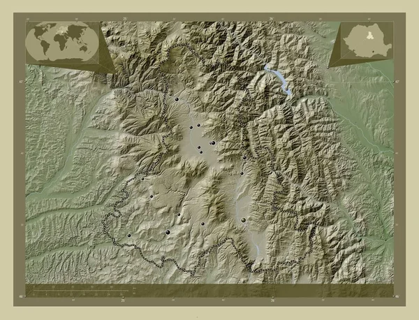
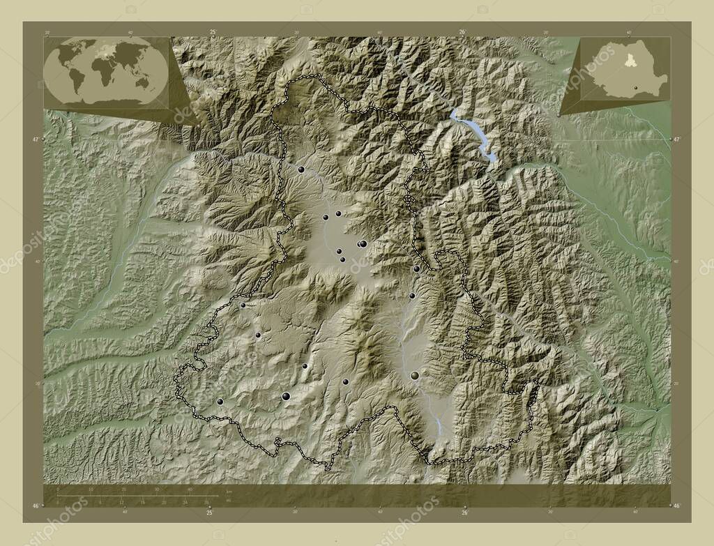
Harghita, county of Romania. Elevation map colored in wiki style with lakes and rivers. Locations of major cities of the region. Corner auxiliary location maps
Esta foto
Harghita, county of Romania. Elevation map colored in wiki style with lakes and rivers. Locations of major cities of the region. Corner auxiliary location maps.
Datos de la Imágen (tiene derechos de autor*)
- Fotografía:
-
Harghita, county of Romania. Elevation map colored in wiki style with lakes and rivers. Locations of major cities of the region. Corner auxiliary location maps
- Autor:
- Ancho original:
-
4930 píxeles.
- Altura original:
-
3770 píxeles.
- Tamaño:
-
18.59 megapíxeles.
- Categorías:
-
- Palabras Clave:
-
Miercurea Ciuc ciumani Rumanía estereográfico cristuru secuiesc forma división administrativa mundo Atlas Leyenda frontera región provincia bucsin odorheiu secuiesc Naturaleza remetea corund ditrau Territorio geografía Ciencia Bucarest lăzarea Europa Gheorgheni Zetea esquema mapa contorno Zoom: Continente Tierras sandominic Balan Harghita planeta Capital social océano país tierra Rou .
Popularidad
- Vistas:
- 0
- Descargas:
- 0
Fotos similares
Otros temas con fotografías que le puede interesar
- Capital social
- ciumani
- Tierras
- geografía
- Harghita
- frontera
- ditrau
- Miercurea Ciuc
- división administrativa
- Gheorgheni
- cristuru secuiesc
- esquema
- estereográfico
- Territorio
- tierra
- Rumanía
- forma
- océano
- lăzarea
- Balan
- región
- Leyenda
- Continente
- Zoom:
- planeta
- Bucarest
- sandominic
- remetea
- contorno
- bucsin
- Ciencia
- corund
- Atlas
- provincia
- Europa
- odorheiu secuiesc
- Rou
- mundo
- mapa
- Zetea
- Naturaleza
- país
(*) Sitio para adquirir: Link externo para Comprar
Fotografía de Harghita, county of Romania. Elevation map colored in wiki style with lakes and rivers. Locations of major cities of the region. Corner auxiliary location maps, que incluye Harghita, county of Romania. Elevation map colored in wiki style with lakes and rivers. Locations of major cities of the region. Corner auxiliary location maps.
Todas las imágenes por Depositphotos