
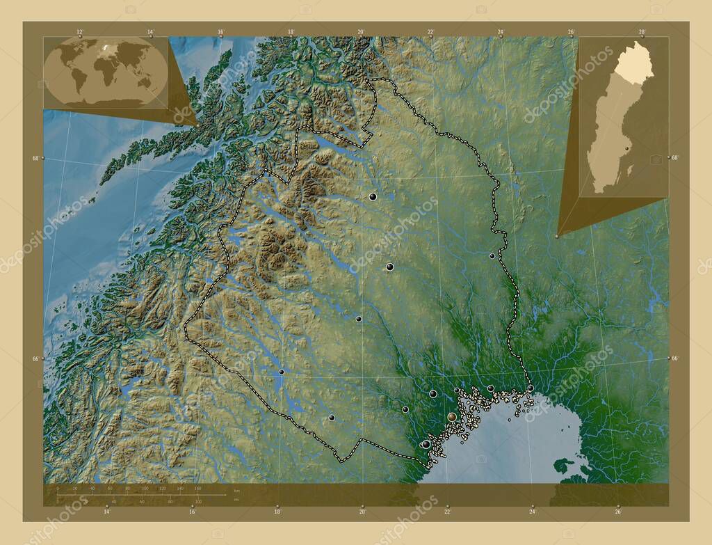
Norrbotten, condado de Suecia. Mapa de elevación de colores con lagos y ríos. Ubicaciones de las principales ciudades de la región. Mapas de ubicación auxiliares de esquina
Esta foto
Norrbotten, condado de Suecia. Mapa de elevación de colores con lagos y ríos. Ubicaciones de las principales ciudades de la región. Mapas de ubicación auxiliares de esquina.
Datos de la Imágen (tiene derechos de autor*)
- Fotografía:
-
Norrbotten, condado de Suecia. Mapa de elevación de colores con lagos y ríos. Ubicaciones de las principales ciudades de la región. Mapas de ubicación auxiliares de esquina
- Autor:
- Ancho original:
-
4930 píxeles.
- Altura original:
-
3770 píxeles.
- Tamaño:
-
18.59 megapíxeles.
- Categorías:
-
- Palabras Clave:
-
suecas Kiruna pitea arjeplog estereográfico Boden Zoom: Leyenda océano división administrativa Lulea Europa alvsbyn Haparanda sodra sunderbyn Pajala tierra ranea región mapa esquema planeta swe provincia país kalix Territorio frontera Arvidsjaur Capital social ESTOCOLMO Atlas Ciencia mundo Naturaleza forma contorno Norrbotten geografía Tierras bergsviken Continente .
Popularidad
- Vistas:
- 0
- Descargas:
- 0
Fotos similares
Otros temas con fotografías que le puede interesar
- Naturaleza
- alvsbyn
- geografía
- Zoom:
- Continente
- suecas
- Haparanda
- swe
- Tierras
- Europa
- Pajala
- arjeplog
- kalix
- pitea
- Ciencia
- Kiruna
- planeta
- Territorio
- división administrativa
- tierra
- Capital social
- ESTOCOLMO
- bergsviken
- Boden
- Norrbotten
- Atlas
- esquema
- mapa
- Leyenda
- país
- océano
- contorno
- frontera
- estereográfico
- Lulea
- mundo
- región
- provincia
- forma
- sodra sunderbyn
- ranea
- Arvidsjaur
(*) Sitio para adquirir: Link externo para Comprar
Fotografía de Norrbotten, condado de Suecia. Mapa de elevación de colores con lagos y ríos. Ubicaciones de las principales ciudades de la región. Mapas de ubicación auxiliares de esquina, que incluye Norrbotten, condado de Suecia. Mapa de elevación de colores con lagos y ríos. Ubicaciones de las principales ciudades de la región. Mapas de ubicación auxiliares de esquina.
Todas las imágenes por Depositphotos